2 years ago
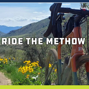
The Methow Valley, located on the eastern flanks of the North Cascades of Washin
2 years ago
Methow Cycle & Sport is a four season, full service bike and nordic ski shop
3 years ago
At Performance Footwear we are focused on guest experience, showing people they
3 years ago
Unfussy strip-mall eatery offering BBQ sandwiches & plates plus sides &
3 years ago
As passionate outdoor enthusiasts ourselves, we not only sell great products, we
3 years ago
We have over 685 guidebook posts which you can filter based on ability level, fa
3 years ago
Owners Pam and Oliver Brulotte of Icicle Brewery and the Munchen Haus in downtow
Registration successful. Activation email has been sent. Please check your mail..
Enter the verification code we just sent
you on your Email Address.
Enter the verification code we just sent
you on your Phone.
If you didn’t receive a code! Resend

Created By:
Leavenworth Area: Construction Delays on Snow Lakes Trail
Date(s): Aug 30, 2021
The Icicle-Peshastin Irrigation District and Washington Department of Fish and Wildlife will be installing a new fish screen from August 2021 – through June 2022.
Trail users should anticipate the potential for 15-30 minute delays from the Icicle Creek bridge through the first ¼ mile of trail during September – October 2021 and March – April 2022. Flaggers will be on site to assure the safety of those accessing the area. Trail users should also expect the intermittent presence of heavy machinery and construction noise. Please observe closures associated with private property and the construction area.
Created By:
Due to the Rooster Comb Fire in south Wenatchee, the Saddle Rock Trailhead is closed until further notice. Trail access via Circle Street is also closed. Dry Gulch Preserve remains closed as well due to fire danger.
Created By:
State Park Closures:
Brooks Memorial -- Back country trails closed until further notice.
Trails on east side of Brooks Memorial closed to the public
Due to extreme fire danger, the trails on the east side of Brooks Memorial (the Brooks back country on the east side of the Learning Center) are closed to the public until further notice. For more information, please call (509) 773-4611.
Camp Wooten -- Closed until further notice
May 4, 2020 2:49 PM
Park closed
This park will remain closed beyond May 5. We are working on the best approach and timing for reopening this and other closed parks.
Columbia Hills -- Crawford Oakes trail system closed until further notice
Ginkgo Petrified Forest -- Back country and petrified log trail closed
August 12, 2021 12:36 PM
The Trees of Stone petrified log trail system is closed
The Trees of Stone petrified log trail system is closed due to high fire danger. The parking lot and trailside museum will remain open
August 12, 2021 12:30 PM
Ginkgo Natural Area closed
Due to extreme fire danger the Ginkgo Natural Area trail is closed until further notice.
Pearrygin State Park --Park closed until further notice
July 20, 2021 1:03 PM
Park closed
Pearrygin Lake State Park is being evacuated due to nearby fires. The park will remain closed until further notice. Overnight guests scheduled to arrive today or tomorrow will receive full refunds, including transaction fees.
We’re monitoring the progression of the fires closely. Learn more at the link below.
Wildfires are affecting air quality and other conditions at many Central and Eastern Washington state parks. To stay up-to-date on conditions affecting your stay, sign up for alerts at https://bit.ly/3kB11iT
Peshastin Pinnacles -- Park closed until further notice
August 5, 2021 2:17 PM
Off-road vehicle areas temporarily closed until further notice
The main off-road vehicle (ORV) and beginner riding areas at Riverside State Park will be temporarily closed for public access beginning on August 6 until further notice.
The closure is based on a number of factors, including current extreme hot and dry conditions, a forecast that shows no meaningful precipitation in the near future, current fuel loads and concern for public safety.
We will continue to monitor the conditions and will determine a reopening date for recreation access once conditions improve.
Other recreation areas at Riverside State Park remain open at this time. Visit our website for wildfire updates and information about park closures at the link below.
For questions, please call the Park office at (509) 465-5064.
Off-road Vehicle Area closed until further notice
Little Spokane Natural area River and Knothead trails closed until further notice
Steamboat Rock -Steamboat Butte Trail and Northrup Canyon closed until further notice
Sun Lakes ELC -- Closed until Spring 2022
Yakima Sportsman -- Undeveloped areas and trails closed until further notice

Created By:
Horselake Road is now closed for wildfire prevention. Horselake area trails can still be accessed from Sage Hills Trailheads.
Created By:
Horselake Road in Wenatchee, which leads to Horse Lake Reserve trails, is closed to motorized vehicles due to the area's extreme fire danger.
The road will remain closed until further notice.
Created By:
July 20, 2021 1:28 PM
PEARRYGIN LAKE STATE PARK CLOSED UNTIL FURTHER NOTICE
Pearrygin Lake State Park is being evacuated due to nearby fires. The park will remain closed until further notice. Overnight guests scheduled to arrive today or tomorrow will receive full refunds, including transaction fees.
We’re monitoring the progression of the fires closely. Please visit our website of additional updates at the link below.
Wildfires are affecting air quality and other conditions at many Central and Eastern Washington state parks.
Created By:
Current WDFW Wildlife Area closures in place to protect public safety
In response to increased fire risk and nationally depleted firefighting resources, all eastern Washington lands, including water access areas within wildlife areas, that WDFW manages will be open for day use only, starting Friday, July 23. Water access sites with allowed overnight camping that are not located in wildlife areas remain open.
Other closures include the:
Rendezvous, Early Winters, and Methow units of the Methow Wildlife Area - closed to all recreation activity
W.T. Wooten Unit of the W.T. Wooten Wildlife Area - closed to all recreation activity
4-0 Ranch and Grouse Flats units of the Chief Joseph Wildlife Area - closed to all recreation activity
Asotin Creek and Weatherly units of the Asotin Creek Wildlife Area - closed to all recreation activity
The overnight use and Methow and Wooten wildlife areas closures will be in effect until further notice. State land managers will meet weekly to assess the possibility for further closures or reopenings. Current closures apply to both motorized and non-motorized uses. WDFW may also implement smaller area-specific road or other closures as necessary. Visit our Wildlife Areas web pages to check for any closures before you go.
Up-to-date information on wildfires in Washington is available on the InciWeb site.
Recreate Responsibly this wildfire season:
Help prevent wildfires during your next trips outdoors by respecting the following restrictions and requirements:
No campfires or target shooting is currently allowed on WDFW lands
No smoking anywhere on WDFW lands except in enclosed vehicles.
Use a required spark arrester on off road vehicles.
No parking on dry grass.
Frequently check under boat and other trailers to remove loose or dragging chains.
No welding or operating chainsaws, acetylene torches or other open flame.
Be a good steward by respecting the closures of other public lands.
Additional wildfire prevention information is available from the Department of Natural Resources website and at recreateresponsibly.org/wildfire-resources.

Created By:
All DNR-managed lands east of the Cascades will be temporarily closed to the public starting Friday
Today, while visiting the Red Apple Fire, Commissioner Franz announced that, due to extreme fire danger and ongoing drought, the Washington State Department of Natural Resources is temporarily closing all recreational and public access to DNR-managed lands in eastern Washington beginning 12:01 a.m. on Friday, July 23.
This temporary closure will apply to DNR-managed state lands, conservation areas, community forests and any associated roads, trails, campgrounds, recreational sites or recreational facilities. The Red Apple Fire alone has burned over 12,000 acres. Across our state, over 900 fires have burned more than 140,000 acres.
“This summer is smashing all our records and leaving the state bone dry, leaving eastern Washington to face an ongoing, tremendous risk of wildfire,” said Commissioner of Public Lands Hilary Franz, the elected official who oversees DNR. “Over the past year and a half, we have been reminded just how important our public lands are, so closing them is not a decision we take lightly. But with the drought leaving the region as dry as ever we must do all that we can to prevent human-caused fires.
“Our firefighters are already stretched thin fighting major fires across our state. We must take reasonable steps – and make sacrifices – in order to protect them and our communities.”
DNR decided to close recreational and public access to its managed lands in eastern Washington based on a number of factors, including current extreme hot and dry conditions, a forecast that shows no meaningful precipitation in the near future, current fuel loads, and a concern for public safety.
After a late-June heat wave that shattered many all-time temperature records across Washington, the vast majority of the state is currently in a drought emergency. Additionally, the number of fire ignitions in the state is approximately double the 10-year average, with months of fire season still to go. In all areas of eastern Washington, fire danger is at very high or extreme levels.
DNR staff will continually monitor conditions, and a reopening date for recreation access will be determined once these factors improve.
The decision to close recreation and all public access on DNR-managed lands east of the Cascades is in addition to the burn ban that Commissioner Franz enacted earlier this month on the 13 million acres of forestlands under DNR fire protection. The burn ban will remain in effect through at least September 30. Campfires also remain banned on DNR-managed lands statewide due to ongoing fire danger.
“Restricting recreational access is something we only do in the most serious of circumstances,” said Angus Brodie, deputy supervisor for state uplands. “However, safety is always our top priority and right now it’s not safe for people to be out on the landscape. We look forward to reopening as soon as the danger recedes.”
DNR joins the Umatilla National Forest and the Confederated Tribes of the Colville Reservation in closing lands in eastern Washington to public access.
Anyone who spots a wildfire should call 911 to report it as soon as possible.
DNR joins the Umatilla National Forest and the Confederated Tribes of the Colville Reservation in closing lands in eastern Washington to public access.
Anyone who spots a wildfire should call 911 to report it as soon as possible.
Get the map of DNR's regions here. To get updates on recreation openings and closures, visit dnr.wa.gov/open.
###
Led by Commissioner of Public Lands Hilary Franz, the Department of Natural Resources is Washington State’s wildfire firefighting force, responsible for preventing and fighting wildfires on 13 million acres of private, state, and tribal-owned lands. The men and women of DNR are committed to ensuring Washington's lands, waters and communities are protected – both today and for future generations.
MEDIA CONTACTS
Paige DeChambeau
Recreation Communications Manager
360-790-1886
Ryan Rodruck
Eastside Communications Manager
360-706-3121

Created By:
Winthrop Area: Thirtymile Road Temporary Closure
Date(s): Jul 12, 2021
Forest Road 5160-250 from where it begins at Andrews Creek Trailhead to its end at Thirtymile
Trailhead will be closed for repair on these dates:
July 19-23, 2021, and July 26-30, 2021. It will be open on July 24 and 25, 2021.
Created By:
Fire emergency area closure within the Methow Valley Ranger District on the Okanogan-Wenatchee National Forest.
UNITED STATES DEPARTMENT OF AGRICULTURE, FOREST SERVICE,
OKANOGAN-WENATCHEE NATIONAL FOREST WINTHROP, WA
Cedar Creek, Varden, and Delancy Fires Closure Order: 06-17-04-21-08
Pursuant to 16 U.S.C. § 551 and 36 CFR § 261.50(a) and (b), and to provide for public safety, the following acts are prohibited within the Methow Valley Ranger District of the Okanogan-Wenatchee National Forest. This Order is effective July 14, 2021, through December 31, 2021, unless rescinded sooner.
PROHIBITIONS:
1. Entering into or being upon National Forest System Lands, as described below and displayed on the attached map, Exhibit A [36 CFR § 261.53(e)].
2. Being on any National Forest System closed trail, as described below and displayed on the attached map, Exhibit A [36 CFR § 261.55(a)].
3. Being on any National Forest System Road as described below and displayed on the attached map, Exhibit A [36 CFR § 261.54(e)].
FIRE EMERGENCY AREA CLOSURE DESCRIPTION:
The Fire Emergency Area Closure is defined as follows:
The closure area begins by Early Winters Campground at the intersection of SR20 and the FS boundary on the east side of the campground. It follows the FS boundary north and to edge of T36NR19ES26 and then west to the FS boundary, including the entirety of the campground and portion of Jack’s Trail (Methow Community Trail) within the FS boundary. It then follows the FS boundary as it jogs south, west and then north across SR20 again to Jack’s Trail, where it turns counterclockwise/ northwest in T36NR19ES27 along bearing 283.5 TN for 1.36 miles to the most prominent SE point on Delancy Ridge at 5,023 feet in T36NR19ES21. SR20 and all portions of Jack’s Trail outside of the Early Winters Campground area will remain open.
It then follows the high divide of Delancy Ridge between the West Fork Methow and Early Winters Creek drainages west to where it intersects the Skagit County boundary line, at a high point just SE of Tower Mountain in T36NR17ES26. It then proceeds south following the high point of the ridge between Swamp Creek and the Pine Creek and Cutthroat Creek drainages until it intersects the Skagit County boundary again, excluding the Pacific Crest Trail #2000. The Pacific Crest Trail #2000 will remain open.
It then follows the Okanogan County boundary south until it intersects the Chelan County boundary in T35NR17ES14, and then east following the Okanogan/Chelan County boundary to a high point of 7562 feet in T35NR18ES18.
It then proceeds at a bearing of 139 degrees TN for 2.79 miles to the intersection of Kangaroo Ridge and the boundary of the Lake Chelan Sawtooth Wilderness in T35NR18ES28. It then follows the Lake Chelan Sawtooth Wilderness boundary southeast to the high point between the N Fork Twisp River, Cedar Creek, and North Creek drainages in T35NR18ES33.
It then follows the high divide south and southeast between the Twisp River and North Creek drainages to the summit of Gilbert Mountain in T34NR18ES2. It then follows a bearing 95 degrees TN 2.61 miles to Abernathy Peak in T34NR19ES6. The entire North Creek Trail #413 is included in the closure area from the junction with the Twisp River Trail #440 to its terminus.
The closure boundary then proceeds south and east along the high divide between the Twisp River and its tributaries and Wolf Creek and its tributaries, until it intersects the Lake Chelan Sawtooth (LCS) Wilderness boundary in T34NR19ES14. It then follows the LCS boundary north and east, and then north and west, crossing Wolf Creek and Wolf Creek Trail #527. The entire Wolf Creek Trail #527 is included in the closure area from the Wolf Creek TH to the trails’ terminus, as well as all other side trails #527.1 and 528 within the closure area. It then follows the LCS boundary north to the intersection T35NR20ES27 and follows the eastern edge of Sections 27 and 22 north to the intersection with the Methow Community Trail #515.
It follows the Methow Community Trail west to the intersection of T35NR20ES22. The Methow Community Trail is not included in the closure area. It then follows the FS boundary north and west until it reaches Early Winters Campground and the intersection with SR20, and the starting point.
SR 20 is not included in this closure.
The following National Forest System facilities, roads, and trails are included in this closure:
Campgrounds
• Early Winters Campground (North and South)
• Klipchuck Campground
• Lone Fir Campground
Roads
• FS Road 5310100 Sandy Butte
• FS Road 5310200 Cedar Creek
• FS Road 53100300 Klipchuck
• FS Road 53100400 Cutthroat Creek
Trails
• Trail #413 North Creek
• Trail #476 Cedar Creek
• Trail #481 Driveway Butte
• Trail #483 Cutthroat Creek
• Trail #522 Early Winters
• Trail #527 and 527.1 Wolf Creek
• Trail #528 North Fork Wolf Creek (unmaintained)
• Trail #535 Lone Fir
• Doe Canyon Trail
• Jack’s Trail (portion within Early Winters Campground only)
See Exhibit A for closure map.
EXEMPTIONS:
Pursuant to 36 CFR § 261.50(e), the following persons are exempt from this Order:
1. Any Federal, State, or local officer, or member of an organized rescue or fire fighting force in the performance of an official duty.
2. Persons with Forest Service Permit No. FS-7700-48 (Permit for Use of Roads, Trails, or Areas Restricted by Regulation Order), specifically authorizing the otherwise prohibited act or omission.
These prohibitions are in addition to the general prohibitions in 36 CFR Part 261, Subpart A. Violations of this prohibition are punishable by a fine of not more than $5,000 for an individualor
$10,000 for an organization, or imprisonment for not more than 6 months, or both (16 U.S.C.
§ 551; 18 U.S.C. §§ 3551, 3559, 3571, and 3581).
Executed in Wenatchee, Washington this 15th Day of July, 2021.
KRISTIN M. BAIL
Forest Supervisor
Okanogan-Wenatchee National Forest
Created By:
TRAIL CLOSURES: Due to fire activity from the Cedar Creek Fire, all trails west of the Mazama trailhead are CLOSED to all users. This includes the Methow Community Trail out towards the Freestone Inn, Jacks, River Run loops. Endless gratitude for the fire and emergency personnel working these fires.
Created By:
Last Updated: 07/14/2021 11:33 AM
In response to the Red Apple Fire that is currently burning north of Wenatchee, a state of emergency has been declared in Chelan County.
A resolution declaring a disaster in Chelan County was signed July 14 by Commissioner Kevin Overbay. County policy allows for one of the three commissioners of Chelan County to declare a state of emergency exists after counseling with public safety officers or Chelan County Emergency Management. Commissioners Bob Bugert and Tiffany Gering will sign the formal resolution on July 19 at the regularly scheduled Board of County Commissioners meeting.
The emergency declaration affords commissioners the ability to use local resources without going through the typical government bidding process for goods and services. It is also generally a prerequisite for most state and federal recovery assistance funding. Governor Jay Inslee earlier this month also declared a statewide state of emergency related to the growing risk of wildfires.
A brush fire was reported at about 6:55 p.m. Tuesday, July 13, near Red Apple Road outside Cashmere. The fire quickly grew over night to about 4,000 acres. The resolution states that 1,065 homes are at Level 3 evacuation status. Those homes are in the Sunnyslope area of Wenatchee, from Highway 2 and Burch Mountain Road to north of Easy Street and American Fruit Road. At this time, there are no reports of dwellings being destroyed.
Updates 7/14/21
11:10am
Road closure informatoin from Washington State Department of Transportation:
US 2 Both Directions - US 97A is closed due to fire activity from north of the Stemilt roundabout, to Swakane Canyon Rd, 9 miles south of Entiat. Travelers should avoid the area and use US 97 as an alternate North-South route. There is currently no estimated time for reopening. From milepost 202 to milepost 206.
Información de cierre de carreteras del Departamento de Transporte del Estado de Washington:
US 2 en ambas direcciones: la US 97A está cerrada debido a la actividad de incendios desde el norte de la rotonda de Stemilt hasta Swakane Canyon Rd, 9 millas al sur de Entiat. Los viajeros deben evitar el área y utilizar la US 97 como ruta alternativa norte-sur. Actualmente no hay un tiempo estimado para reabrir. Desde el poste de la milla 202 al poste de la milla 206.
Update 11:25pm
Level 3 - LEAVE NOW
West Eagle Rock Drive
May Lane
Anna Lane
North Ridge Drive
Sequoia Lane
April Lane
Actualización 11:25 pm
Nivel 3 - SALIR AHORA
West Eagle Rock Drive
May Lane
Anna Lane
North Ridge Drive
Sequoia Lane
April Lane
Level 2 - Prepare to Leave
Rue Jolie down to American Fruit Rd and over to School St.
Nivel 2 - Prepárese para partir
Rue Jolie hasta American Fruit Rd y luego hasta School St
Actualización 11:25 pm
Nivel 3 - SALIR AHORA
West Eagle Rock Drive
May Lane
Anna Lane
North Ridge Drive
Sequoia Lane
April Lane
Created By:
Varden/Cedar/Delancy Fire Update
Release Date: Jul 13, 2021
July 13, 2021 — Both the Varden and Cedar Creek Fires had active fire behavior and saw an increase in size over the last two days. These wildfires fires were caused by the thunderstorm that came through north central Washington on July 8.
The Varden Fire located approximately 5.5 miles west of Mazama, WA., on the south side of State Route 20 and is estimated at over 1000 acres. Crews continue to prep along highway from Silver Star Creek to the Cedar Creek trailhead by reducing fuels close to the road and removing dead trees that could pose a hazard to firefighters and the emergency response vehicles.
Yesterday dozers and hand crews started constructing line along the base of Sandy Butte toward Lucky Jim Bluff to help prevent the spread of the fire into the valley bottom towards Mazama and surrounding communities. Crews continue to assess options to stop spread to the southeast.
The Cedar Creek Fire, located roughly 3 miles southwest of Mazama, is estimated at 175 acres in size.
The Delancy Fire is located roughly 10 miles west of Mazama, north of State Route 20, and has not grown over the last operational period.
Northwest Type II Interagency Incident Management Team #8 took over management of the fires at 6:00 a.m. July 13.
The team is in process of establishing a phone line for additional information and setting up information boards. The next fire information update will come out from the team this evening. We appreciate your patience during this transition period.
Facebook page: facebook.com/MazamaFires2021
InciWeb page: inciweb.nwcg.gov/incident/7655
State Route 20 North Cascades Highway remains closed to all traffic due to fire activity between milepost 170 and 178. Closed approximately 20 miles west of Winthrop between Silver Star and Early Winters. There is no estimated time for reopening of the road.
STATE ROUTE 20 UPDATES GO TO WSDOT:
For Highway 20 updates go to WSDOT:
wsdot.com/traffic/trafficalerts/default.aspx
EVACUATION INFORMATION:
Please see Okanogan County Emergency Management page for current status.
WEATHER:
A Fire weather watch has been issued for Wednesday, July 14 through Thursday, July 15 for very dry and breezy to windy conditions. West to southwest winds 15-25 mph with gusts up to 35 mph and relative humidity as low as 10% will be possible. New fires could spread rapidly. Heed all fire restrictions. Use caution with fire triggers (grills, cars, campfires, etc.).
SMOKE INFORMATION:
The Forest Service works closely with other federal and state partners to predict and mitigate smoke impacts on individuals and communities during wildfires, visit wasmoke.blogspot.com for local air quality information.
FIRE RESTRICTIONS:
Campfire restrictions are in effect. Campfires are prohibited throughout the Okanogan-Wenatchee National Forest, including developed campgrounds and Wilderness areas. Call local ranger district offices for more information or visit Fire Restrictions page.
Created By:
News from the current fires in the Methow Valley area:
- Highway 20 is closed near Mazama
From WSDOT:
SR 20 North Cascades Highway between milepost 170 and 177 (appx. 20 miles west of Winthrop between Silver Star and Early Winters) **AS OF MONDAY, JULY 12 AT 10AM: ROAD CLOSED to all traffic due to fire activity.** There is no estimated time for reopening of the road. Cross-state travel is available on US 2 and I-90.
Last Updated: 7/12/2021 1:06 PM
From milepost 170 to milepost 178
https://www.wsdot.com/traffic/trafficalerts/default.aspx?route=SR%2020&view=MAINWEATHER&action=3
- Recent lightning has sparked a few fires near Mazama. Expect trail and campground closures to take effect today in the vicnity of Mazama. Early Winters Campground has been closed as well as the Cedar Creek Trailhead.
https://methowvalleynews.com/2021/07/12/fires-burn-on-national-forest-land-near-mazama/
- There is also a flash flood warning in effect from the National Weather Service for the evening of Monday 7/12/21.
https://forecast.weather.gov/MapClick.php?lat=48.59369000000004&lon=-120.40719999999999#.YOyo80xlBEE
Created By:
BURN BAN
Outdoor burning, the use of charcoal briquettes, and prescribed burns are banned on all forest lands within the State of Washington under Department of Natural Resources fire protection through September 30, 2021. This date may be extended or shortened based upon ongoing fire conditions.
What are the consequences for starting a wildfire during a burn restriction?
A burn restriction violation is a crime. Anyone caught burning may be issued a ticket or prosecuted.
In addition to criminal prosecution, DNR may pursue civil actions against any person whose negligence is responsible for starting, or allowing, a fire to spread.
If your fire escapes, you will be responsible for paying for fire suppression personnel and equipment, as required by state law.
Created By:
Due to extreme fire danger from high temperatures and potential human caused fire, all trails on Dry Gulch Preserve will be closed immediately to the public until further notice.
We aim to hopefully open up again by the 4th.
Dry Gulch preserve is a privately held property and does not belong to the Chelan Douglas Land Trust.
For more information, please email DryGulchPreserve@gmail.com

Created By:
Summer is here! Chelan PUD is asking for your assistance regarding public safety in the Chelan River Gorge.
Please help Chelan PUD spread the word: Stay on trails in the upper reaches of the Chelan River and abide by “no trespassing” signs in other areas, specifically in the Chelan River Gorge.
The Chelan Gorge is the narrow, rocky channel of the Chelan River, located in an area with limited cell phone coverage and hazardous terrain. Rescues are extremely difficult. Changes in river flow can create hazardous conditions quickly and unpredictably, including higher water levels, fast currents, and potential entrapment. Chelan PUD has posted dozens of signs warning of the no-trespass areas for public safety.
Press release with more:
Warning: Increasing water flow in the Chelan River (chelanpud.org)
As you may know, last year several individuals entered the Chelan River Gorge and were trapped when an unexpected but necessary spill event occurred from Lake Chelan Dam. The spill event trapped the individuals in the Gorge, requiring rescue by local rescue teams.
Created By:
EXCESSIVE HEAT WARNING
Temperatures in Wenatchee Valley will reach 112 degrees by Monday
https://forecast.weather.gov/MapClick.php?lat=47.42255000000006&lon=-120.32009#.YNUVUkxlBhF
...EXCESSIVE HEAT WARNING IN EFFECT FROM FRIDAY AFTERNOON THROUGH THURSDAY EVENING...
* WHAT...Dangerously hot conditions will develop in central Washington on Friday and build into eastern Washington and north Idaho over the weekend.
* WHERE...Portions of North and North Central Idaho. Portions of Central, East Central, North Central, Northeast, and Southeast Washington.
* WHEN...From Friday through Thursday, and possibly into next weekend.
* IMPACTS...Unprecedented triple digit heat and unusually warm overnight temperatures will make it difficult to control the build up of heat in homes without air conditioning.
* ADDITIONAL DETAILS...This event will likely be one of the most extreme and prolonged heat waves in the recorded history of the Inland Northwest. Unprecedented heat will not only threaten the health of residents in the Inland Northwest but will make our region increasingly vulnerable to wildfires and intensify the impacts our ongoing drought.
PRECAUTIONARY/PREPAREDNESS ACTIONS... Drink plenty of fluids, stay in an air-conditioned room, stay out of the sun, and check up on relatives and neighbors. Going to a place with air conditioning even for a couple hours can help mitigate heat stress. Consider going to a shopping mall, local library, or community center for relief. Do not leave young children and pets in unattended vehicles. Car interiors will reach lethal temperatures in a matter of minutes. Take extra precautions when outside. Wear lightweight and loose fitting clothing. Try to limit strenuous activities to early morning or evening. Take action when you see symptoms of heat exhaustion and heat stroke.
Created By:
https://www.fs.usda.gov/Internet/FSE_DOCUMENTS/fseprd910644.pdf
HIKERS and HORSE USERS ALERT--The bridge on Icicle Creek Trail #1551, 1½ miles from the trailhead, was damaged over the winter and is not safe to use. This trail is located at the end of Icicle Valley, just beyond the Black Pine Horse Camp, and accesses the French Creek area of the Alpine Lakes Wilderness. Trails #1551 and #1595 are impacted and unavailable due to the loss of the use of this bridge. As high runoff is likely to continue for some time from the heavy winter snowpack, fording is not an option until water levels diminish. Contact the Wenatchee River Ranger District at 509-548-2550 for more information.
Created By:
Weed Control Spraying April 26th - May 7th in Wenatchee Foothills Area
A contractor will be spraying weeds in the Foothills area, on Chelan PUD property, and on other properties in the area during the week of April 26.
The contractor will be using side-by-side ATVs and backpack sprayers to conduct weed control efforts.
Created By:
The Ski Hill trails that are open today:
For the Boys to Freund, Lower Rosy, Magic Carpet, and Fluid all dry and ridable!!!!!
The rest Of the Ski Hill trails are wet and have snow stay tuned for more updates soon.
Created By:
Sage Hills trail sytem is curent closed for mule deer habitat. The PUD is conducting mule deer surveys this week. Even though the weather is nice and the trails are inviting, please respect this closure unti April 1st. Recreators, especially with dogs off leash, can cause serious strain to this habitat.
Created By:
BACKCOUNTRY AVALANCHE FORECAST
Avalanche Warning. Very dangerous conditions exist due to ongoing snow and wind and weak old layers of snow. You could trigger large to very large avalanches including unsurvivable persistent slab avalanches from far away. Stay off of and out from underneath steep open slopes.
Created By:
WENATCHEE, WA – Sage Hills trails system will close for four months starting Dec. 1 to provide winter sustenance and quiet rangeland for mule deer and other wildlife. The area will re-open for outdoor recreation around April 1.
Created By:
Intermittent Trail closures
Expect periodic closures for Sage Hills & Horse Lake trail systems during the next few weeks for public safety. Chelan PUD will be working in the area to replace transmission line poles. Helicopters will be flying over the area, carrying heavy materials.
Created By:
CHELAN PUD PLANS TRANSMISSION POLE REPLACEMENT AT HORSE LAKE RESERVE
Fire resiliency and long-term maintenance investment cited
WENATCHEE -- Trail users can expect short-term, intermittent closures along the Horse Lake Trail system from mid-October to mid-November while Chelan PUD replaces four wooden transmission line structures with steel poles. The intermittent trail closures are necessary for public safety while a helicopter flies in materials overhead, and crews operate heavy machinery in the area. Trail users will also see flaggers and signs at the work site.
“The construction timeline is tight between fire season and wet conditions in the fall,” says Steve Wickel, Transmission Engineering Manager at Chelan PUD. “By using a helicopter, we can reduce the number of trips to the work site with materials and heavy equipment, and reduce impacts to the reserve. After the work is finished, the site will be seeded to help restore natural habitat for the long term.”
The work schedule is dependent on weather, which can be unpredictable in fall. Before heading to the foothills, be sure to check chelanpud.org or cdlandtrust.org for trail status updates.
Created By:
The Apple Capital Loop Trail between Confluence State Park and Odabashian Bridge will be temporarily rerouted for about two months during a riverbank restoration project.
Beginning Sept. 21, trail users can follow detour signs along city streets: Euclid Avenue, Penny Road, Isenhart Avenue, and Olds Station Road. The work is estimated to be completed by Nov. 10th.
Created By:
Recreation alert: DNR Recreation lands east of the Cascades will reopen on Friday, September 18.
Created By:
The Washington State Department of Natural Resources (DNR) is extending the closure of all of the lands it manages east of the Cascades to recreation due to high fire danger through Thursday, September 17.
Created By:
All DNR-managed lands east of the Cascades are closed to recreation starting Tuesday morning due to the ongoing high fire danger. The closure will last at least through Friday. DNR staff will evaluate the possibility of extending the closure as the week goes on.
Created By:
Wildfire Smoke & Unhealthy Air Quality East Wenatchee, WA – Public Health officials urge Chelan and Douglas County residents to stay home due to the wildfire smoke and unhealthy air quality conditions. Wildfire smoke can cause serious health problems, especially for at risk people including: children, pregnant women, adults older than 65, and people with heart and lung diseases or respiratory illnesses. The best way to protect your and your family’s health during a wildfire is to limit time spent outdoors. The following are steps you can take to improve the air quality inside your home: • Keep windows and doors closed to avoid smoky air from coming inside; • Avoid bringing outdoor air inside by setting air conditioner(s) to “recirculate”; • Avoid adding indoor air pollution and do not vacuum, use candles, or smoke; and • Use a portable air cleaner with a HEPA (High Efficiency Particulate Air) filter. Stay informed of the latest wildfires and air quality information by visiting the Washington Smoke Blog. Remain aware of smoky conditions and follow the precautions stated in the Washington Air Quality Advisory.
Created By:
Tree has been cleared from the Waterslide trail.
Created By:
Tree down on Waterslide. Use caution.
Created By:
Starting August 14, campfires banned in the Okanogan-Wenatchee National Forest
Wenatchee, WA (August 13, 2020) – Worsening fire danger conditions have prompted forest officials to expand campfire restrictions across the entire Okanogan-Wenatchee National Forest, which includes national forest campgrounds and Wilderness areas. These restrictions go into effect Friday, August 14.
Under the Forest-wide restriction, the use of wood and charcoal campfires is banned; however, people will still be able to use pressurized liquid gas stoves, pressurized liquid gas fires, or an enclosed solid fuel fire that utilizes a wick to distribute a flame. Wood burning camp stoves sometimes used by hunters will not be allowed.
Created By:
The Loop Trail will be temporarily closed August 10th between 15th and 19th streets for hazard tree removal. Trail should reopen around noon.
Created By:
Chikamin Fire update:
The following road and trails are closed to public entry:
FS Road #6210 - Chikamin Road Trail 1548 - Lower Chiwawa Trail 1534 - Chikamin Tie Trail 1524 - Minnow Ridge Trail 1515 - Basalt Ridge Trail 1530 - Basalt Pass Trail 1538 - Rock Creek Tie Trail 1408 - Garland Peak Trail 1409.1 - Upper Mad River Trail 1523 - Alder Ridge Trail 1561 - Chikamin Tie Trail 1539 - Minnow Creek Trail 1429 – Shetipo
Created By:
Welcome to TREAD map.
Updated App will be coming soon.
The app will automatically update as soon as the stores approve the new build which means users will not have to reinstall. It shouldn’t be more than a couple days (we hope).
Again, thank you for your understanding.
Thank you!
Created By:
TREAD Map Beta Testers!
Send along your feedback, bug reports or any questions to:
marc.rothmeyer@mobcoder.com
lyonsm483@gmail.com
THANK YOU!
Created By:
Protect Yourself, Others, and the Outdoors
During this public health crisis, spending time in outdoor spaces has become even more important for many Americans. Yet these unusual circumstances mean that all of us, from seasoned outdoor enthusiasts to families heading out to their local park for the first time, could use a little guidance about how to stay safe. The Recreate Responsibly guidelines offer a starting point for getting outside to keep yourself healthy and to maintain access to our parks, trails, and beaches.
Created By:
Debido al incendio de Rooster Comb en el sur de Wenatchee, el Saddle Rock Trailhead está cerrado hasta nuevo aviso. El acceso al sendero a través de Circle Street también está cerrado. Dry Gulch Preserve también permanece cerrada debido al peligro de incendio.
Created By:
Cierres de parques estatales:
Brooks Memorial -- Senderos de la parte trasera cerrados hasta nuevo aviso.
Los senderos del lado este del Brooks Memorial están cerrados al público
Debido al extremo peligro de incendio, los senderos del lado este del Brooks Memorial (el campo trasero de Brooks en el lado este del Centro de Aprendizaje) están cerrados al público hasta nuevo aviso. Para más información, llame al (509) 773-4611.
Campamento Wooten -- Cerrado hasta nuevo aviso
4 de mayo de 2020 2:49 PM
Parque cerrado
Este parque permanecerá cerrado después del 5 de mayo. Estamos trabajando en el mejor enfoque y calendario para reabrir este y otros parques cerrados.
Columbia Hills -- Sistema de senderos Crawford Oakes cerrado hasta nuevo aviso
Ginkgo Petrified Forest -- Sendero de troncos petrificados cerrado
12 de agosto de 2021 12:36 PM
El sistema de senderos de troncos petrificados de Trees of Stone está cerrado
El sistema de senderos de troncos petrificados de Trees of Stone está cerrado debido al alto peligro de incendio. El aparcamiento y el museo junto al sendero permanecerán abiertos
12 de agosto de 2021 12:30 PM
El Área Natural de Ginkgo está cerrada
Debido al extremo peligro de incendio, el sendero del Área Natural de Ginkgo está cerrado hasta nuevo aviso.
Pearrygin State Park --Parque cerrado hasta nuevo aviso
20 de julio de 2021 1:03 PM
Parque cerrado
El Parque Estatal del Lago Pearrygin está siendo evacuado debido a los incendios cercanos. El parque permanecerá cerrado hasta nuevo aviso. Los huéspedes que pasen la noche programados para llegar hoy o mañana recibirán reembolsos completos, incluidos los gastos de transacción.
Estamos siguiendo de cerca la progresión de los incendios. Obtenga más información en el siguiente enlace.
Los incendios forestales están afectando a la calidad del aire y a otras condiciones en muchos parques estatales del centro y el este de Washington. Para mantenerse al día sobre las condiciones que afectan a su estancia, inscríbase para recibir alertas en https://bit.ly/3kB11iT
Peshastin Pinnacles -- Parque cerrado hasta nuevo aviso
Parque Estatal Riverside
5 de agosto de 2021 2:17 PM
Áreas de vehículos todoterreno cerradas temporalmente hasta nuevo aviso
Las principales áreas de vehículos todoterreno (ORV) y de principiantes en el Parque Estatal de Riverside estarán cerradas temporalmente para el acceso del público a partir del 6 de agosto hasta nuevo aviso.
El cierre se basa en una serie de factores, incluyendo las condiciones actuales de calor y sequedad extremos, un pronóstico que muestra que no hay precipitaciones significativas en un futuro próximo, las cargas de combustible actuales y la preocupación por la seguridad pública.
Seguiremos vigilando las condiciones y determinaremos una fecha de reapertura del acceso recreativo una vez que las condiciones mejoren.
Otras áreas recreativas del Parque Estatal de Riverside siguen abiertas en este momento. Visite nuestro sitio web para ver las actualizaciones de los incendios forestales y la información sobre los cierres de los parques en el siguiente enlace.
Si tiene preguntas, llame a la oficina del parque al (509) 465-5064.
Área de vehículos todoterreno cerrada hasta nuevo aviso
Área natural de Little Spokane Río y senderos de Knothead cerrados hasta nuevo aviso
Steamboat Rock -Steamboat Butte Trail y Northrup Canyon cerrados hasta nuevo aviso
Sun Lakes ELC -- Cerrado hasta la primavera de 2022
Yakima Sportsman -- Zonas no urbanizadas y senderos cerrados hasta nuevo aviso
Traducción realizada con la versión gratuita del traductor www.DeepL.com/Translator
Created By:
Horselake Road ahora está cerrado para la prevención de incendios forestales. Todavía se puede acceder a los senderos del área de Horselake desde Sage Hills Trailheads.
Created By:
Horselake Road en Wenatchee, que conduce a los senderos de Horse Lake Reserve, está cerrado a los vehículos motorizados debido al peligro extremo de incendio de la zona.
La carretera permanecerá cerrada hasta nuevo aviso.
Created By:
20 de julio de 2021 1:28 PM
PARQUE ESTATAL DEL LAGO PEARRYGIN CERRADO HASTA NUEVO AVISO
El Parque Estatal del Lago Pearrygin está siendo evacuado debido a los incendios cercanos. El parque permanecerá cerrado hasta nuevo aviso. Los huéspedes que pasen la noche programados para llegar hoy o mañana recibirán reembolsos completos, incluidos los gastos de transacción.
Estamos siguiendo de cerca la progresión de los incendios. Por favor, visite nuestro sitio web de actualizaciones adicionales en el enlace de abajo.
Los incendios forestales están afectando a la calidad del aire y otras condiciones en muchos parques estatales del centro y el este de Washington.
Traducción realizada con la versión gratuita del traductor www.DeepL.com/Translator
Created By:
Los actuales cierres de las áreas de vida silvestre del WDFW están en vigor para proteger la seguridad pública
En respuesta al aumento del riesgo de incendios y a los recursos de extinción de incendios agotados a nivel nacional, todas las tierras del este de Washington, incluyendo las áreas de acceso al agua dentro de las áreas de vida silvestre, que el WDFW gestiona estarán abiertas para el uso diurno solamente, a partir del viernes 23 de julio. Los sitios de acceso al agua con acampada nocturna permitida que no están ubicados en áreas de vida silvestre permanecen abiertos.
Otros cierres incluyen el:
Las unidades Rendezvous, Early Winters y Methow del Área de Vida Silvestre Methow - cerradas a toda actividad recreativa
Unidad W.T. Wooten del Área de Vida Silvestre W.T. Wooten - cerrada a toda actividad recreativa
Unidades 4-0 Ranch y Grouse Flats del Área de Vida Silvestre de Chief Joseph - cerradas a toda actividad recreativa
Unidades de Asotin Creek y Weatherly del Área de Vida Silvestre de Asotin Creek - cerradas a toda actividad recreativa
El uso nocturno y los cierres de las áreas de vida silvestre de Methow y Wooten estarán vigentes hasta nuevo aviso. Los administradores de tierras estatales se reunirán semanalmente para evaluar la posibilidad de nuevos cierres o reaperturas. Los cierres actuales se aplican tanto a los usos motorizados como a los no motorizados. El WDFW también puede aplicar cierres de carreteras u otros cierres en áreas más pequeñas según sea necesario. Visite nuestras páginas web de Áreas Silvestres para comprobar si hay cierres antes de ir.
La información actualizada sobre los incendios forestales en Washington está disponible en el sitio InciWeb.
Recréese de forma responsable en esta temporada de incendios forestales:
Ayude a prevenir los incendios forestales durante sus próximas salidas al aire libre respetando las siguientes restricciones y requisitos:
Actualmente no se permiten las hogueras ni el tiro al blanco en las tierras del WDFW
No se puede fumar en ninguna parte de las tierras del WDFW, excepto en los vehículos cerrados.
Utilizar un supresor de chispas obligatorio en los vehículos todoterreno.
No se puede aparcar en la hierba seca.
Compruebe con frecuencia bajo el barco y otros remolques para eliminar las cadenas sueltas o de arrastre.
No soldar ni operar motosierras, sopletes de acetileno u otras llamas abiertas.
Sea un buen administrador respetando los cierres de otros terrenos públicos.
Encontrará más información sobre la prevención de incendios forestales en el sitio web del Departamento de Recursos Naturales y en recreateresponsibly.org/wildfire-resources.
Traducción realizada con la versión gratuita del traductor www.DeepL.com/Translator
Created By:
Todas las tierras gestionadas por el DNR al este de las Cascadas estarán temporalmente cerradas al público a partir del viernes
Hoy, mientras visitaba el incendio de Red Apple, el Comisario Franz anunció que, debido al extremo peligro de incendio y a la actual sequía, el Departamento de Recursos Naturales del Estado de Washington está cerrando temporalmente todo el acceso público y recreativo a las tierras gestionadas por el DNR en el este de Washington a partir de las 12:01 a.m. del viernes 23 de julio.
Este cierre temporal se aplicará a las tierras estatales gestionadas por el DNR, a las áreas de conservación, a los bosques comunitarios y a todas las carreteras, senderos, zonas de acampada, lugares de recreo o instalaciones recreativas asociadas. Sólo el incendio de la manzana roja ha quemado más de 12.000 acres. En todo el estado, más de 900 incendios han quemado más de 140.000 acres.
"Este verano está batiendo todos nuestros récords y dejando el estado totalmente seco, lo que hace que el este de Washington se enfrente a un riesgo tremendo y continuo de incendios forestales", dijo la Comisaria de Tierras Públicas, Hilary Franz, la funcionaria elegida que supervisa el DNR. "Durante el último año y medio, se nos ha recordado lo importantes que son nuestros terrenos públicos, por lo que cerrarlos no es una decisión que tomemos a la ligera. Pero con la sequía que deja a la región tan seca como siempre, debemos hacer todo lo que podamos para prevenir los incendios provocados por el hombre".
"Nuestros bomberos ya están muy ocupados luchando contra los grandes incendios en todo el estado. Debemos tomar medidas razonables -y hacer sacrificios- para protegerlos a ellos y a nuestras comunidades".
El DNR decidió cerrar el acceso público y recreativo a sus tierras gestionadas en el este de Washington basándose en una serie de factores, entre los que se incluyen las condiciones actuales de calor extremo y sequedad, una previsión que no muestra precipitaciones significativas en un futuro próximo, la carga actual de combustible y la preocupación por la seguridad pública.
Tras una ola de calor a finales de junio que batió muchos récords históricos de temperatura en todo Washington, la mayor parte del estado se encuentra actualmente en situación de emergencia por sequía. Además, el número de incendios en el estado es aproximadamente el doble de la media de 10 años, con meses de temporada de incendios aún por delante. En todas las zonas del este de Washington, el peligro de incendio está en niveles muy altos o extremos.
El personal del DNR supervisará continuamente las condiciones, y se determinará una fecha de reapertura del acceso recreativo una vez que estos factores mejoren.
La decisión de cerrar las actividades recreativas y todo el acceso público en las tierras gestionadas por el DNR al este de las Cascadas se suma a la prohibición de quemar que el Comisario Franz promulgó a principios de este mes en los 13 millones de acres de tierras forestales bajo la protección contra incendios del DNR. La prohibición de quemar permanecerá en vigor al menos hasta el 30 de septiembre. Las hogueras también están prohibidas en los terrenos gestionados por el DNR en todo el estado debido al peligro de incendio.
"Restringir el acceso recreativo es algo que sólo hacemos en las circunstancias más graves", dijo Angus Brodie, supervisor adjunto de las tierras altas del estado. "Sin embargo, la seguridad es siempre nuestra máxima prioridad y en este momento no es seguro para la gente estar en el paisaje. Esperamos poder reabrir tan pronto como el peligro disminuya".
El DNR se une al Bosque Nacional de Umatilla y a las Tribus Confederadas de la Reserva de Colville en el cierre de las tierras del este de Washington al acceso del público.
Cualquier persona que vea un incendio forestal debe llamar al 911 para informar lo antes posible.
El DNR se une al Bosque Nacional de Umatilla y a las Tribus Confederadas de la Reserva de Colville para cerrar las tierras del este de Washington al acceso del público.
Cualquier persona que vea un incendio forestal debe llamar al 911 para informar lo antes posible.
Obtenga el mapa de las regiones del DNR aquí. Para obtener información actualizada sobre las aperturas y cierres de zonas de recreo, visite dnr.wa.gov/open.
###
Dirigido por el Comisionado de Tierras Públicas Hilary Franz, el Departamento de Recursos Naturales es la fuerza de lucha contra los incendios forestales del Estado de Washington, responsable de la prevención y la lucha contra los incendios forestales en 13 millones de acres de tierras privadas, estatales y tribales. Los hombres y mujeres del DNR se comprometen a garantizar la protección de las tierras, aguas y comunidades de Washington, tanto hoy como para las generaciones futuras.
CONTACTOS CON LOS MEDIOS DE COMUNICACIÓN
Paige DeChambeau
Gerente de Comunicaciones de Recreación
360-790-1886
paige.dechambeau@dnr.wa.gov
Ryan Rodruck
Gerente de Comunicaciones del Lado Este
360-706-3121
ryan.rodruck@dnr.wa.gov
Traducción realizada con la versión gratuita del traductor www.DeepL.com/Translator
Created By:
Área de Winthrop: Cierre temporal de Thirtymile Road
Fecha (s): 12 de julio de 2021
Forest Road 5160-250 desde donde comienza en Andrews Creek Trailhead hasta su final en Thirtymile
El comienzo del sendero estará cerrado por reparaciones en estas fechas:
Del 19 al 23 de julio de 2021 y del 26 al 30 de julio de 2021. Abrirá los días 24 y 25 de julio de 2021.
Created By:
Cierre del área de emergencia por incendio dentro del distrito de guardabosques de Methow Valley en el bosque nacional Okanogan-Wenatchee.
DEPARTAMENTO DE AGRICULTURA DE LOS ESTADOS UNIDOS, SERVICIO FORESTAL,
WINTHROP DEL BOSQUE NACIONAL DE OKANOGAN-WENATCHEE, WA
Orden de cierre de incendios de Cedar Creek, Varden y Delancy: 06-17-04-21-08
De conformidad con 16 U.S.C. § 551 y 36 CFR § 261.50 (a) y (b), y para garantizar la seguridad pública, los siguientes actos están prohibidos dentro del Distrito de Guardaparques de Methow Valley del Bosque Nacional Okanogan-Wenatchee. Esta Orden entra en vigencia desde el 14 de julio de 2021 hasta el 31 de diciembre de 2021, a menos que se rescinda antes.
PROHIBICIONES:
1. Entrar o estar en Tierras del Sistema Forestal Nacional, como se describe a continuación y se muestra en el mapa adjunto, Anexo A [36 CFR § 261.53 (e)].
2. Estar en cualquier sendero cerrado del Sistema Forestal Nacional, como se describe a continuación y se muestra en el mapa adjunto, Anexo A [36 CFR § 261.55 (a)].
3. Estar en cualquier Carretera del Sistema Forestal Nacional como se describe a continuación y se muestra en el mapa adjunto, Anexo A [36 CFR § 261.54 (e)].
DESCRIPCIÓN DEL CIERRE DEL ÁREA DE EMERGENCIA POR INCENDIO:
El cierre del área de emergencia por incendio se define de la siguiente manera:
El área de cierre comienza en Early Winters Campground en la intersección de SR20 y el límite de FS en el lado este del campamento. Sigue el límite de FS hacia el norte y hasta el borde de T36NR19ES26 y luego hacia el oeste hasta el límite de FS, incluida la totalidad del campamento y la parte de Jack's Trail (Methow Community Trail) dentro del límite de FS. Luego sigue el límite FS mientras trota hacia el sur, oeste y luego hacia el norte a través de SR20 nuevamente hacia Jack's Trail, donde gira en sentido antihorario / noroeste en T36NR19ES27 a lo largo de la dirección 283.5 TN durante 1.36 millas hasta el punto SE más prominente en Delancy Ridge a 5,023 pies en T36NR19ES21. La SR20 y todas las partes de Jack's Trail fuera del área de Early Winters Campground permanecerán abiertas.
Luego sigue la división alta de Delancy Ridge entre los drenajes West Fork Methow y Early Winters Creek hacia el oeste hasta donde se cruza con la línea fronteriza del condado de Skagit, en un punto alto justo al SE de Tower Mountain en T36NR17ES26. Luego avanza hacia el sur siguiendo el punto más alto de la cresta entre Swamp Creek y los drenajes de Pine Creek y Cutthroat Creek hasta que se cruza nuevamente con el límite del condado de Skagit, excluyendo el Pacific Crest Trail # 2000. El Pacific Crest Trail # 2000 permanecerá abierto.
Luego sigue el límite del condado de Okanogan hacia el sur hasta que se cruza con el límite del condado de Chelan en T35NR17ES14, y luego hacia el este siguiendo el límite del condado de Okanogan / Chelan hasta un punto alto de 7562 pies en T35NR18ES18.
Luego procede con un rumbo de 139 grados TN durante 2.79 millas hasta la intersección de Kangaroo Ridge y el límite del lago Chelan Sawtooth Wilderness en T35NR18ES28. Luego sigue el límite de Lake Chelan Sawtooth Wilderness hacia el sureste hasta el punto más alto entre los drenajes N Fork Twisp River, Cedar Creek y North Creek en T35NR18ES33.
Luego sigue la alta división sur y sureste entre los drenajes del río Twisp y North Creek hasta la cima de la montaña Gilbert en T34NR18ES2. Luego sigue un rumbo 95 grados TN 2.61 millas hasta Abernathy Peak en T34NR19ES6. Todo el North Creek Trail # 413 está incluido en el área de cierre desde el cruce con el Twisp River Trail # 440 hasta su término.
El límite de cierre luego avanza hacia el sur y el este a lo largo de la división alta entre el río Twisp y sus afluentes y Wolf Creek y sus afluentes, hasta que se cruza con el límite del desierto del lago Chelan Sawtooth (LCS) en T34NR19ES14. Luego sigue el límite de LCS al norte y al este, y luego al norte y al oeste, cruzando Wolf Creek y Wolf Creek Trail # 527. Todo el Wolf Creek Trail # 527 está incluido en el área de cierre desde Wolf Creek TH hasta el final de los senderos, así como todos los demás senderos laterales # 527.1 y 528 dentro del área de cierre. Luego sigue el límite de LCS hacia el norte hasta la intersección T35NR20ES27 y sigue el borde este de las Secciones 27 y 22 hacia el norte hasta la intersección con Methow Community Trail # 515.
Sigue el Methow Community Trail hacia el oeste hasta la intersección de T35NR20ES22. El Methow Community Trail no está incluido en el área de cierre. Luego sigue el límite de FS hacia el norte y el oeste hasta llegar a Early Winters Campground y la intersección con SR20, y el punto de partida.
SR 20 no está incluido en este cierre.
Las siguientes instalaciones, caminos y senderos del Sistema Nacional Forestal están incluidos en este cierre:
Campamentos
• Campamento de invierno temprano (norte y sur)
• Campamento Klipchuck
• Campamento Lone Fir
Carreteras
• FS Road 5310100 Sandy Butte
• FS Road 5310200 Cedar Creek
• FS Road 53100300 Klipchuck
• FS Road 53100400 Cutthroat Creek
Caminos
• Sendero 413 North Creek
• Sendero 476 Cedar Creek
• Sendero # 481 Driveway Butte
• Sendero 483 Cutthroat Creek
• Sendero # 522 Primeros inviernos
• Sendero # 527 y 527.1 Wolf Creek
• Sendero # 528 North Fork Wolf Creek (sin mantenimiento)
• Sendero # 535 Lone Fir
• Sendero Doe Canyon
• Jack's Trail (solo parte dentro de Early Winters Campground)
Consulte el Anexo A para ver el mapa de cierre.
EXENCIONES:
De conformidad con 36 CFR § 261.50 (e), las siguientes personas están exentas de esta Orden:
1. Cualquier oficial federal, estatal o local, o miembro de una fuerza organizada de rescate o extinción de incendios en el desempeño de un deber oficial.
2. Personas con Permiso del Servicio Forestal No. FS-7700-48 (Permiso de Uso de Carreteras, Senderos o Áreas Restringidas por Orden de Regulación), autorizando específicamente el acto u omisión de otro modo prohibido.
Estas prohibiciones son adicionales a las prohibiciones generales en 36 CFR Parte 261, Subparte A. Las violaciones de esta prohibición se castigan con una multa de no más de $ 5,000 para un individuo o
$ 10,000 para una organización, o encarcelamiento por no más de 6 meses, o ambos (16 U.S.C.
§ 551; 18 U.S.C. §§ 3551, 3559, 3571 y 3581).
Ejecutado en Wenatchee, Washington, el día 15 de julio de 2021.
KRISTIN M. BAIL
Supervisor forestal
Bosque Nacional Okanogan-Wenatchee
Created By:
Actualización Varden / Cedar / Delancy Fire
Fecha de lanzamiento: 13 de julio de 2021
13 de julio de 2021: los incendios Varden y Cedar Creek tuvieron un comportamiento de fuego activo y vieron un aumento de tamaño en los últimos dos días. Estos incendios forestales fueron causados por la tormenta eléctrica que atravesó el centro norte de Washington el 8 de julio.
El incendio de Varden se encuentra aproximadamente a 5.5 millas al oeste de Mazama, WA., En el lado sur de la ruta estatal 20 y se estima en más de 1000 acres. Los equipos continúan preparándose a lo largo de la carretera desde Silver Star Creek hasta el comienzo del sendero Cedar Creek al reducir los combustibles cerca de la carretera y eliminar los árboles muertos que podrían representar un peligro para los bomberos y los vehículos de respuesta a emergencias.
Ayer, las topadoras y los equipos manuales comenzaron a construir una línea a lo largo de la base de Sandy Butte hacia Lucky Jim Bluff para ayudar a prevenir la propagación del fuego hacia el fondo del valle hacia Mazama y las comunidades circundantes. Los equipos continúan evaluando opciones para detener la propagación hacia el sureste.
El Cedar Creek Fire, ubicado aproximadamente a 3 millas al suroeste de Mazama, se estima en 175 acres de tamaño.
El Delancy Fire está ubicado aproximadamente a 10 millas al oeste de Mazama, al norte de la ruta estatal 20, y no ha crecido durante el último período operativo.
El Equipo de Manejo de Incidentes Interagencial de Tipo II del Noroeste # 8 se hizo cargo de la gestión de los incendios a las 6:00 a.m. del 13 de julio.
El equipo está en proceso de establecer una línea telefónica para obtener información adicional y crear paneles de información. La próxima actualización de información sobre incendios saldrá del equipo esta noche. Agradecemos su paciencia durante este período de transición.
Página de Facebook: facebook.com/MazamaFires2021
Página InciWeb: inciweb.nwcg.gov/incident/7655
La ruta estatal 20 North Cascades Highway permanece cerrada a todo el tráfico debido a la actividad de incendios entre los postes de milla 170 y 178. Cerrada aproximadamente a 20 millas al oeste de Winthrop entre Silver Star y Early Winters. No hay un tiempo estimado para la reapertura de la carretera.
ACTUALIZACIONES DE STATE ROUTE 20 IR A WSDOT:
Para obtener actualizaciones de Highway 20, vaya a WSDOT:
wsdot.com/traffic/trafficalerts/default.aspx
INFORMACIÓN DE EVACUACIÓN:
Consulte la página de Administración de emergencias del condado de Okanogan para conocer el estado actual.
TIEMPO:
Se ha emitido una alerta meteorológica contra incendios para el miércoles 14 de julio hasta el jueves 15 de julio para condiciones muy secas y con viento a viento. Serán posibles vientos de oeste a suroeste de 15-25 mph con ráfagas de hasta 35 mph y humedad relativa tan baja como 10%. Los nuevos incendios podrían propagarse rápidamente. Preste atención a todas las restricciones contra incendios. Tenga cuidado con los desencadenantes de incendios (parrillas, automóviles, fogatas, etc.).
INFORMACIÓN SOBRE HUMO:
El Servicio Forestal trabaja en estrecha colaboración con otros socios federales y estatales para predecir y mitigar los impactos del humo en las personas y las comunidades durante los incendios forestales. Visite wasmoke.blogspot.com para obtener información local sobre la calidad del aire.
RESTRICCIONES DE FUEGO:
Las restricciones de fogatas están vigentes. Las fogatas están prohibidas en todo el Bosque Nacional Okanogan-Wenatchee, incluidos los campamentos desarrollados y las áreas silvestres. Llame a las oficinas locales del distrito de guardabosques para obtener más información o visite la página de Restricciones de incendios.
Created By:
Noticias de los incendios actuales en el área de Methow Valley:
- La autopista 20 está cerrada cerca de Mazama.
Desde WSDOT:
SR 20 North Cascades Highway entre la milla 170 y 177 (aprox. 20 millas al oeste de Winthrop entre Silver Star y Early Winters) ** A PARTIR DEL LUNES 12 DE JULIO A LAS 10AM: CARRETERA CERRADA a todo el tráfico debido a la actividad de incendios. ** Hay no hay tiempo estimado para reapertura de la carretera. Los viajes entre estados están disponibles en la US 2 y la I-90.
Última actualización: 7/12/2021 1:06 PM
De la milla 170 a la milla 178
https://www.wsdot.com/traffic/trafficalerts/default.aspx?route=SR%2020&view=MAINWEATHER&action=3
- Un rayo reciente ha provocado algunos incendios cerca de Mazama. Espere que los cierres de senderos y campamentos entren en vigencia hoy en las cercanías de Mazama. El campamento Early Winters se ha cerrado, así como Cedar Creek Trailhead.
https://methowvalleynews.com/2021/07/12/fires-burn-on-national-forest-land-near-mazama/
- También hay una advertencia de inundación repentina en vigor del Servicio Meteorológico Nacional para la noche del lunes 7/12/21.
https://forecast.weather.gov/MapClick.php?lat=48.59369000000004&lon=-120.40719999999999#.YOyo80xlBEE
Created By:
PROHIBICIÓN DE QUEMAR
La quema al aire libre, el uso de briquetas de carbón y las quemas prescritas están prohibidas en todas las tierras forestales dentro del estado de Washington bajo la protección contra incendios del Departamento de Recursos Naturales hasta el 30 de septiembre de 2021. Esta fecha puede extenderse o acortarse según las condiciones de incendio en curso.
¿Cuáles son las consecuencias de iniciar un incendio forestal durante una restricción de quema?
Una infracción de la restricción de quemaduras es un delito. Cualquiera que sea sorprendido en llamas puede recibir una multa o ser procesado.
Además del enjuiciamiento penal, DNR puede emprender acciones civiles contra cualquier persona cuya negligencia sea responsable de iniciar o permitir que se propague un incendio.
Si su incendio se escapa, usted será responsable de pagar por el personal y el equipo de extinción de incendios, según lo exige la ley estatal.
Created By:
Debido al peligro extremo de incendio de alta temperatura y el potencial incendio causado por el hombre, todos los senderos en Dry Gulch Preserve se cerrarán inmediatamente al público hasta nuevo aviso.
Nuestro objetivo es abrir de nuevo para el día 4.
Dry Gulch preserve es una propiedad privada y no pertenece al Chelan Douglas Land Trust.
Para obtener más información, envíe un correo electrónico a DryGulchPreserve@gmail.com
Created By:
¡El verano está aquí! Chelan PUD solicita su ayuda con respecto a la seguridad pública en Chelan River Gorge.
Por favor, ayude a Chelan PUD a correr la voz: manténgase en los senderos en los tramos superiores del río Chelan y respete las señales de “no traspasar” en otras áreas, específicamente en la garganta del río Chelan.
Chelan Gorge es el canal estrecho y rocoso del río Chelan, ubicado en un área con cobertura limitada de teléfonos celulares y terreno peligroso. Los rescates son extremadamente difíciles. Los cambios en el flujo del río pueden crear condiciones peligrosas de forma rápida e impredecible, incluidos niveles de agua más altos, corrientes rápidas y posibles atrapamientos. Chelan PUD ha colocado docenas de letreros que advierten de las áreas prohibidas para la seguridad pública.
Comunicado de prensa con más:
Advertencia: aumento del flujo de agua en el río Chelan (chelanpud.org)
Como sabrá, el año pasado varias personas ingresaron a la garganta del río Chelan y quedaron atrapadas cuando ocurrió un derrame inesperado pero necesario en la presa del lago Chelan. El evento del derrame atrapó a las personas en el desfiladero, lo que requirió el rescate por parte de los equipos de rescate locales.
Created By:
ADVERTENCIA DE CALOR EXCESIVO
Las temperaturas en el valle de Wenatchee alcanzarán los 112 grados el lunes
https://forecast.weather.gov/MapClick.php?lat=47.42255000000006&lon=-120.32009#.YNUVUkxlBhF
... ADVERTENCIA DE CALOR EXCESIVO EN EFECTO DESDE EL VIERNES POR LA TARDE HASTA EL JUEVES POR LA NOCHE ...
* QUÉ ... Se desarrollarán condiciones peligrosamente calurosas en el centro de Washington el viernes y se acumularán en el este de Washington y el norte de Idaho durante el fin de semana.
* DÓNDE ... Porciones del norte y centro norte de Idaho. Porciones del centro, este del centro, norte del centro, noreste y sureste de Washington.
* CUÁNDO ... De viernes a jueves, y posiblemente hasta el próximo fin de semana.
* IMPACTOS ... El calor de tres dígitos sin precedentes y las temperaturas inusualmente cálidas durante la noche harán que sea difícil controlar la acumulación de calor en hogares sin aire acondicionado.
* DETALLES ADICIONALES ... Este evento probablemente será una de las olas de calor más extremas y prolongadas en la historia registrada del Inland Northwest. El calor sin precedentes no solo amenazará la salud de los residentes en el interior del noroeste, sino que hará que nuestra región sea cada vez más vulnerable a los incendios forestales e intensificará los impactos de nuestra sequía en curso.
ACCIONES DE PRECAUCIÓN / PREPARACIÓN ... Beba muchos líquidos, permanezca en una habitación con aire acondicionado, no se exponga al sol y controle a familiares y vecinos. Ir a un lugar con aire acondicionado incluso por un par de horas puede ayudar a mitigar el estrés por calor. Considere ir a un centro comercial, una biblioteca local o un centro comunitario para recibir alivio. No deje niños pequeños ni mascotas en vehículos sin vigilancia. Los interiores de los automóviles alcanzarán temperaturas letales en cuestión de minutos. Tome precauciones adicionales cuando esté al aire libre. Use ropa ligera y holgada. Trate de limitar las actividades extenuantes a primera hora de la mañana o de la noche. Actúe cuando observe síntomas de agotamiento por calor e insolación.
Created By:
https://www.fs.usda.gov/Internet/FSE_DOCUMENTS/fseprd910644.pdf
ALERTA PARA CAMINANTES Y USUARIOS DE CABALLOS - El puente en Icicle Creek Trail # 1551, a 1½ millas del comienzo del sendero, fue dañado durante el invierno y no es seguro de usar. Este sendero está ubicado al final de Icicle Valley, un poco más allá del Black Pine Horse Camp, y accede al área de French Creek de Alpine Lakes Wilderness. Los senderos # 1551 y # 1595 se ven afectados y no están disponibles debido a la pérdida del uso de este puente. Como es probable que la alta escorrentía continúe durante algún tiempo debido a la intensa capa de nieve del invierno, vadear no es una opción hasta que disminuyan los niveles de agua. Comuníquese con el distrito de guardabosques del río Wenatchee al 509-548-2550 para obtener más información.
Created By:
Fumigación para el control de malezas del 26 de abril al 7 de mayo en el área de Wenatchee Foothills
Un contratista rociará malezas en el área de Foothills, en la propiedad de Chelan PUD y en otras propiedades en el área durante la semana del 26 de abril. El contratista utilizará vehículos todo terreno de uno al lado del otro y rociadores de mochila para llevar a cabo los esfuerzos de control de malezas.
Created By:
Las pistas de Ski Hill que están abiertas hoy: ¡Para los chicos a Freund, Lower Rosy, Magic Carpet y Fluid todo seco y manejable! El resto de los senderos de Ski Hill están mojados y tienen nieve. Estén atentos para más actualizaciones pronto.
Created By:
El sistema de senderos Sage Hills está actualmente cerrado para el hábitat del venado bura. El PUD está llevando a cabo encuestas sobre venados bura esta semana. Aunque el clima es agradable y los senderos son atractivos, respete este cierre hasta el 1 de abril. Los recreadores, especialmente con perros sin correa, pueden causar una gran tensión en este hábitat.
Created By:
PREVISIÓN DE AVALANCHA DE BACKCOUNTRY
Advertencia de avalancha. Existen condiciones muy peligrosas debido a la nieve y el viento en curso y las débiles capas de nieve viejas. Puede desencadenar avalanchas de grandes a muy grandes, incluidas avalanchas de losas persistentes insuperables desde lejos. Manténgase alejado de las pendientes abiertas y empinadas.
Created By:
WENATCHEE, WA - El sistema de senderos de Sage Hills se cerrará durante cuatro meses a partir del 1 de diciembre para proporcionar sustento invernal y pastizales tranquilos para el venado bura y otros animales salvajes. El área reabrirá para recreación al aire libre alrededor del 1 de abril.
Created By:
Cierres de senderos intermitentes Se esperan cierres periódicos para los sistemas de senderos de Sage Hills y Horse Lake durante las próximas semanas por seguridad pública. Chelan PUD estará trabajando en el área para reemplazar los postes de la línea de transmisión. Los helicópteros sobrevolarán la zona transportando materiales pesados.
Created By:
CHELAN PUD PLANEA EL REEMPLAZO DEL POSTE DE TRANSMISIÓN EN LA RESERVA HORSE LAKE Se cita la inversión en resistencia al fuego y mantenimiento a largo plazo WENATCHEE - Los usuarios de senderos pueden esperar cierres intermitentes a corto plazo a lo largo del sistema Horse Lake Trail desde mediados de octubre hasta mediados de noviembre, mientras que Chelan PUD reemplaza cuatro estructuras de líneas de transmisión de madera con postes de acero. Los cierres intermitentes de senderos son necesarios para la seguridad pública mientras un helicóptero sobrevuela materiales y las cuadrillas operan maquinaria pesada en el área. Los usuarios de los senderos también verán banderilleros y letreros en el lugar de trabajo. “El cronograma de construcción es ajustado entre la temporada de incendios y las condiciones de humedad en el otoño”, dice Steve Wickel, Gerente de Ingeniería de Transmisión en Chelan PUD. “Al utilizar un helicóptero, podemos reducir el número de viajes al sitio de trabajo con materiales y equipo pesado, y reducir los impactos a la reserva. Una vez finalizado el trabajo, se sembrará el sitio para ayudar a restaurar el hábitat natural a largo plazo ". El horario de trabajo depende del clima, que puede ser impredecible en otoño. Antes de dirigirse a las estribaciones, asegúrese de consultar chelanpud.org o cdlandtrust.org para conocer las actualizaciones del estado de los senderos.
Created By:
El Apple Capital Loop Trail entre Confluence State Park y Odabashian Bridge se desviará temporalmente durante aproximadamente dos meses durante un proyecto de restauración de la ribera. A partir del 21 de septiembre, los usuarios del sendero pueden seguir las señales de desvío a lo largo de las calles de la ciudad: Euclid Avenue, Penny Road, Isenhart Avenue y Olds Station Road. Se estima que el trabajo estará terminado para el 10 de noviembre.
Created By:
Alerta de recreación: Las tierras de recreación del DNR al este de Cascades reabrirán el viernes 18 de septiembre.
Alerta de recreación: Las tierras de recreación del DNR al este de Cascades reabrirán el viernes 18 de septiembre.
Created By:
El Departamento de Recursos Naturales del Estado de Washington (DNR) está extendiendo el cierre de todas las tierras que administra al este de las Cascadas para recreación debido al alto peligro de incendio hasta el jueves 17 de septiembre.
Created By:
Todas las tierras administradas por el DNR al este de Cascades están cerradas a la recreación a partir del martes por la mañana debido al alto peligro de incendios en curso. El cierre durará al menos hasta el viernes. El personal del DNR evaluará la posibilidad de extender el cierre a medida que avance la semana.
Created By:
El árbol ha sido despejado del sendero Waterslide.
Created By:
Árbol en tobogán. Con precaución.
Created By:
A partir del 14 de agosto, se prohibieron las fogatas en el Bosque Nacional Okanogan-Wenatchee Wenatchee, WA (13 de agosto de 2020) - El empeoramiento de las condiciones de peligro de incendios ha llevado a los funcionarios forestales a expandir las restricciones de fogatas en todo el Bosque Nacional Okanogan-Wenatchee, que incluye campamentos forestales nacionales y áreas silvestres. Estas restricciones entran en vigencia el viernes 14 de agosto. Según la restricción de todo el bosque, se prohíbe el uso de fogatas de leña y carbón; sin embargo, las personas aún podrán usar estufas de gas líquido presurizado, fuegos de gas licuado presurizado o un fuego de combustible sólido cerrado que utiliza una mecha para distribuir una llama. No se permitirán las estufas de campamento de leña que a veces usan los cazadores.

Created By:
El Loop Trail estará cerrado temporalmente el 10 de agosto entre las calles 15 y 19 para la remoción de árboles peligrosos. El sendero debería reabrirse alrededor del mediodía.
Created By:
Para garantizar la seguridad pública y la seguridad de los bomberos en Chikamin Fire, los siguientes caminos y senderos están cerrados a la entrada pública:
FS Road # 6210 - Chikamin Road Trail 1548 - Lower Chiwawa Trail 1534 - Chikamin Tie Trail 1524 - Minnow Ridge Trail 1515 - Basalt Ridge Trail 1530 - Basalt Pass Trail 1538 - Rock Creek Tie Trail 1408 - Garland Peak Trail 1409.1 - Upper Mad River Trail 1523 - Alder Ridge Trail 1561 - Chikamin Tie Trail 1539 - Minnow Creek Trail 1429 - Shetipo
Created By:
Bienvenido al mapa TREAD
La aplicación se actualizará automáticamente tan pronto como las tiendas aprueben la nueva compilación, lo que significa que los usuarios no tendrán que reinstalar. No debería ser más de un par de días (esperamos).
Se actualizará automáticamente en sus dispositivos.
¡Gracias!
La aplicación se actualizará automáticamente tan pronto como las tiendas aprueben la nueva compilación, lo que significa que los usuarios no tendrán que reinstalar. No debería ser más de un par de días (esperamos). Nuevamente, gracias por su comprensión.
Created By:
¡TREAD Map Beta Testers! Envíe sus comentarios, informes de errores o cualquier pregunta a: marc.rothmeyer@mobcoder.com lyonsm483@gmail.com ¡GRACIAS!
Created By:
Protégete a ti mismo, a los demás y al aire libre
Durante esta crisis de salud pública, pasar tiempo en espacios al aire libre se ha vuelto aún más importante para muchos estadounidenses. Sin embargo, estas circunstancias inusuales significan que todos, desde entusiastas experimentados al aire libre hasta familias que se dirigen a su parque local por primera vez, podríamos usar una pequeña guía sobre cómo mantenerse a salvo. Las pautas de Recreate Responsibly ofrecen un punto de partida para salir y mantenerse saludable y mantener el acceso a nuestros parques, senderos y playas.
#RecreateResponsibly